-
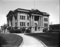 1002
1002 Twin Falls County Court House; Twin Falls High School on left, Presbyterian Church in background
-
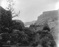
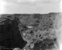
 935
935 "Sentinel Gate;" lake in the bottom of Devil's Corral, with a large rock formations
-
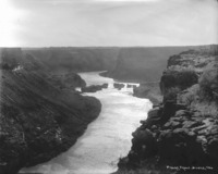
 1001
1001 "Upper Salmon Falls;" view from creek level, rock formation in middle
-
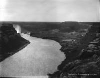
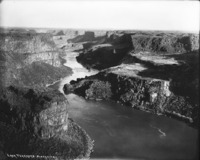 934
934 "Lava Terraces;" Snake River winding through its canyon
-
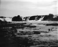
 1000
1000 "Upper Salmon Falls;" view from creek level, rock formation in middle
-
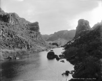
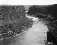
 933
933 "Devil's Gate;" Snake River viewed through a narrow canyon from the bottom of Devil's Corral
-
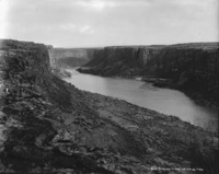
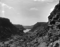 932
932 "Rift in the Rocks;" Snake River flowing through the canyon as viewed from Devil's Corral
-
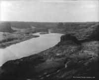
 931
931 "Ripple Bend;" turn in the Snake River Canyon
-
 930
930 "Old Spring Town;" view of the Snake River (Spring Town was a gold mining settlement in the 1880-1890s)
-
 929
929 "Old China Town;" view of the Snake River; (Chinese mining settlement in the 1880-1890s near here)
-
 928
928 "Lost Lake;" hidden lake in the canyon immediately upstream from Shoshone Falls
-
 927
927 "The Mist of Shoshone;" distant view of the top of Shoshone Falls from upstream
-
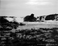
 926
926 "Pillar Falls;" long view of falls in the river
-
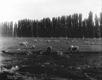 925
925 "Peaceful Pasture;" poplar enclosed pasture of sheep
-
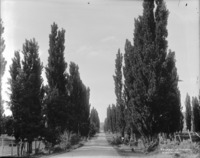 924
924 "Evergreen Highway;" road in the canyon lined with poplars